

Finding your parked vehicle missing or broken into after returning from the shops in Carlton, a meal out in Mapperley or hitting the gym in Arnold is every local driver’s worst nightmare.
But now help is at hand to help you find safe parking in the borough with the launch of a new interactive map by Co-op insurance.
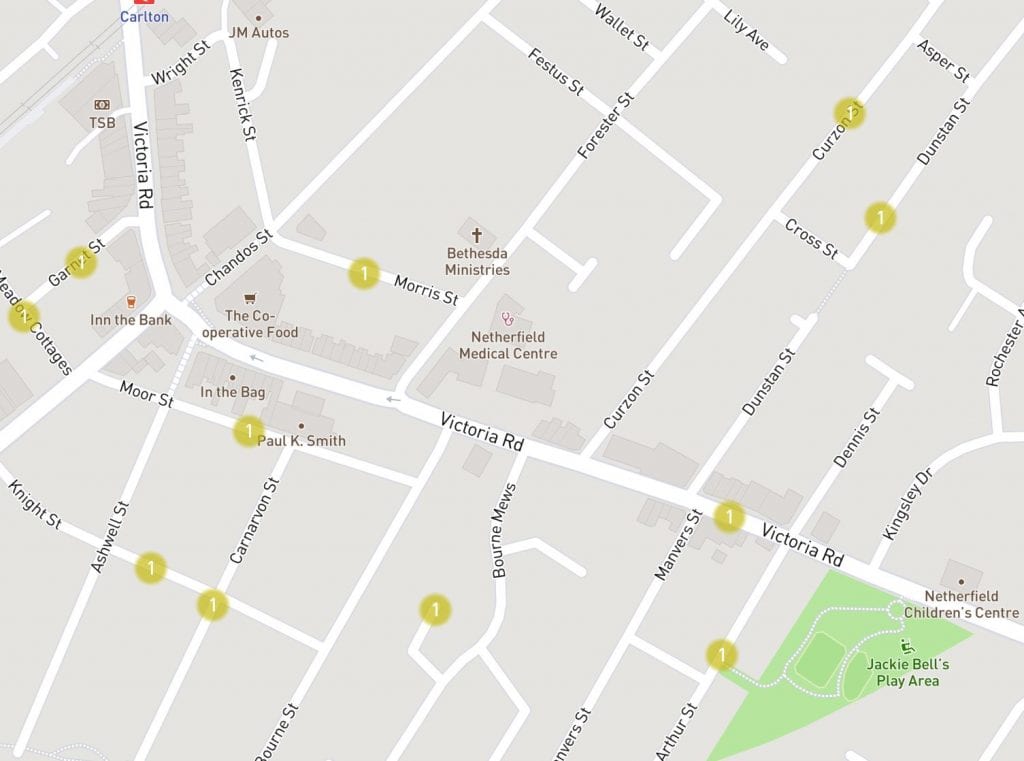
The tool uses Home Office data to reveal the safest places to park in the local area – and also the UK.
Users enter a location or postcode into the Park Smart tool to see the number of vehicle crimes over the last six months.
The Co-op said they hope the tool will help people to make an informed decision on where to leave their car.
The Park Smart tool uses data from November 2016 – April 2017, published by the Home Office, to display the number of vehicle crimes in the area selected over the last six months.
Red circles on the map represent areas where six or more incidents have taken place within the last six months; orange circles represent areas where three to five incidents have occurred.
Finally, yellow circles show areas where zero to two incidents have occurred.
Gedling Eye tried out the tool and on several postcodes from across the borough.
In Netherfield we found all the roads showing yellow circles, with one incident of car crime taking place on some of the town’s various streets.

In Carlton, we found an orange circle showing on Southdale Drive – indicating 3-5 vehicle crimes had taken place there within the last six months.

Yellow circles on Plains Road revealed that four incidents of car crime had taken place there during the last few months.

Why not try out the tool for yourself by visiting: https://hub.co-opinsurance.co.uk/park-smart/
Co-op insurance has also created a blog with tips on how to keep your car safe.


